Fred Smeins, Sam Fuhlendorf and Charles Taylor, Jr.
Introduction
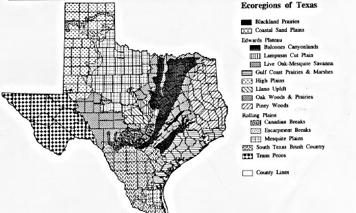
The focus of this symposium is on two species of juniper (cedar), Ashe (Juniperus ashei) and Redberry (Juniperus pinchotii), that are important vegetation components of the Edwards Plateau, the Rolling Plains and portions of adjacent ecoregions of Texas (Figures 1 and 2)(Hatch et al. 1990). Across rangeland regions of North America woody vegetation has generally increased in abundance relative to grasslands during the past 150 years (Smeins 1984, Archer 1994). Juniper species in particular have extended their geographic ranges, as well as increased their abundance (Miller and Wigand 1994, Ansley et al. 1995). This chapter will address historical changes that have influenced the environment, the vegetation and ultimately man’s use of the land in the Edwards Plateau and Rolling Plains and specifically address the status of Ashe and Redberry juniper. A brief assessment of pre-European settlement history (Holocene and Native American period) will be presented to set the stage. This will be followed by a review of known and speculated changes that have occurred since settlement and up to the present time (ca. the last 300 years).
Many factors influence contemporary vegetation composition and structure. Included are:
- long-term (Holocene: last 10,000 yrs) changes and fluctuations of the climate,
- recent changes in weather and climate including droughts, wet periods, and perhaps temperature change due to increased greenhouse gases in the atmosphere, etc.,
- influence of Native Americans (last 12,000? years),
- alteration in the distributions, numbers and kinds of wild animal populations,
- introduction of domestic livestock and ultimately widespread overstocking of the ranges,
- natural or man-caused alterations in soil conditions that increase surface heterogeneity of the soil,
- alteration of fire regimes, and
- interaction of all of the above; individual factors rarely operate in isolation in the real world but rather are telescoped upon one another and interact in multifarious ways.
A major problem when interpreting historical changes is that the record is woefully incomplete and unbalanced. Some issues that must be kept in mind when interpreting historical changes are:
- the further back in time the less complete and accurate the record,
- the location within an ecoregion from which information is available constrains interpretations since most records are site or local terrain specific and do not necessarily represent the entire region,
- when written records become available they are highly influenced by the technical competence, experience, time of observation, motivation and objectives of the observer.
Hence caution is required when conducting any sort of historical assessment. In spite of these qualifications, when consistent patterns arise from different sources of information reasonable interpretations can be accomplished.
With the above qualifications an attempt will be made to piece together what we know or suspect has happened in this region from about 10,000 years ago to the present. Information presented will be skewed in favor of the Edwards Plateau since 1) it is the region with the greatest amount of available information and 2) it is the region of greatest familiarity to the authors. Ultimately, does knowledge of these factors of change provide clues to the contemporary distribution and abundance patterns of Ashe and Redberry juniper?
Long-term Climate Change
During the Pleistocene (ice ages; last 2,000,000 years), there were several glacial-interglacial cycles where ice sheets expanded and receded over major portions of Canada, the northern United States and high evaluations of mountainous regions (Butzer 1976). The most recent glacier (Wisconsin) reached its peak about 15,000 to 20,000 years ago and had receded from the United States about 11,000 years ago (Delcourt and Delcourt 1981, Wright 1981). The current interglacial (Holocene) began about 10,000 years ago.
At the peak of glacial expansion, vegetation and climate of Texas were much different than today. As glaciers developed the climate of Texas became cooler and moisture effectiveness was greater which resulted in the presence of plant species that today typically occur in more mesic or cooler environments (Van Devender and Spaulding 1979). For example, the current distribution of many eastern forest species that extend into central and West Texas, such as bald cypress (Taxodium disticum), Chinkapin oak (Quercus muhlengergii), redbud (Cercis canadensis) and many others, may have occurred during these more favorable glacial conditions. Likewise, western species such as papershell pinon pine (Pinus remota), which was widespread across all of the current desert and arid grasslands of the Trans-Pecos region and onto the Edwards Plateau during the advance of the last glacier (Van Devender and Spaulding, 1979), bigtooth maple (Acer grandidentatum), madrone (Arbutus xalapensis) and other species that still exist in central Texas, may be persisting today on favorable sites but were more widespread during the glacial periods. Also, boreal forest species, such as spruce (Picea glauca), are documented to have extended as far south as Texas (Bryant 1975).
Present climatic and vegetational regimes of the Southwestern United States began to develop about 10,000 years ago and were more or less established about 8,000 years ago (Bryant and Shafer 1977, Van Devender and Spaulding 1979, Cole 1982). For the central United States, the period of time from 7,000 to 5,000 years ago (Holocene Maximum, Xerothermic, Altithermal) is identified as a time of warm, dry conditions, followed by, in more recent times, somewhat cooler and wetter conditions (McAndrews 1967, Delcourt and Delcourt 1981). Nordt et al. (1994) have documented this warming and drying period from evaluation of stable carbon isotopes in the organic matter of paleosols (fossil soils) on the Fort Hood Military Reservation. Fossil pollen analysis from the Lower Pecos River indicates a similar phenomenon (Bryant 1986). There is also evidence of a short-term warming and drying period about 2,000 years ago. It is suggested, however, that in west Texas, the cooler, wetter conditions never returned but rather a gradual trend toward increased aridity continued to the present (Hafsten 1961, Bryant and Shafer 1977, Van Devender and Spaulding 1979).
This drying trend (on a geologic time scale) continues today; therefore, some of the current vegetation of Texas may have developed under a previous set of climatic conditions characterized by cooler, more moist conditions than exist today. Vegetation often has sufficient inertia to persist under current climatic conditions, but if severely disturbed may not be able to reestablish and correspondingly may readily change in composition and structure.
Recent Climate Change
Over the past 10,000 years most of the state of Texas has generally become progressively warmer and drier with, of course, various fluctuations through time. During the most recent 1000 years there are some climatic variations that may be noteworthy relative to vegetation. Beginning about 1000 years ago the earth’s temperature became warmer up until about 600 years ago. This Medieval Warm Period is characterized by retreating mountain glaciers, and documented shifts in vegetation distributions in various parts of the world. From 600 to 150 years ago the earth experience a cooling period known as the Little Ice Age. Many of the changes observed in the previous warm period were reversed. From about 1850 to the present the earth has been in a warming mode. These shifting temperature patterns and associated moisture changes are believed by some to have significant influence on woody plant increases across North American rangelands. Neilson (1986) concluded that the climate of the Little Ice Age favored C4 (warm season grasses) plants over plants with the C3 photosynthetic pathway (cool season grasses and all forbs and woody plants). Also during this period the concentration of carbon dioxide and other greenhouse gases has increased in the atmosphere. This is perhaps the cause of the increase in the earth’s temperature over the past 150 years but as importantly increased carbon dioxide concentrations could further favor the growth of C3 plants (woody) species (Archer et al. 1995).
The climate is a fluctuating phenomenon and expresses periodic droughts of several years duration often followed by several years of above normal precipitation. The timing and sequencing of these dry/wet cycles may predispose some areas to woody plant invasion. Even distant events such as the El Nino/Southern Oscillation off the west coast of South America are now known to have major impacts on weather at great distances. Droughts in various areas are highly correlated with these events as are associated increased forest fire frequencies and other vegetation altering impacts (Swetnam and Betancourt 1990).
As the above phenomena become better understood along with some of the longer term changes that have occurred during the Holocene, perhaps it will be determined that climate and weather may have greater influences on vegetation changes than currently suspected. For the present, evidence exists for change in both climate and vegetation over time, however, the connection between the two is not easily established and specifics as related to the distribution and abundance of Ashe and Redberry juniper are speculative.
Native American Influences
Evidence of prehistoric habitation of central and west Texas can be traced to at least 12,000 years ago (Hester 1986). These early Americans apparently crossed from Siberia to Alaska by way of the Bering land bridge. They were skilled hunters and food gatherers and adapted quickly to the resources they found.
Through time these inhabitants exerted more and more influence on their environment. For example, fossil deposits of as recently as 10,000 years ago show human activity areas closely associated with now extinct large herbivores (mammoths, sloths, horses, giant bison, camels, and others) and their predators. These megafauna had existed and coevolved for some 20 million years and in just a few thousand years the number of genera was reduced to one-third its former level (Smeins 1984, Martin, 1975). Some scientists believe that the early humans caused these extinctions directly through over-hunting (Martin 1975). An alternative view suggests that the cause was change in climate following the retreat of the Wisconsin glacier (Briuer 1971, Lundelius 1976). Prior to this extinction event in North American, these herbivores and their predators exceeded in diversity and abundance the large animals of modern day East Africa. Their ultimate demise, whatever the cause, no doubt has had a major influence on the composition and structure of the vegetation over the past 10,000 years. If Martin’s hypothesis is correct that over-hunting by early humans caused these extinctions, these first Americans could have exerted a major influence on the ecological conditions of Texas, long before the arrival of modern European man.
Native American populations increased in number and were widespread across the Edwards Plateau and Rolling Plains for the past several thousand years. By at least 5,000 years ago they were using fire to process food as evidence by the widespread occurrence of “burned rock middens” (Hester 1986). These middens may represent areas where acorns (removal of tannic acid) and other foods were processed (Hester 1986, McConnell 1933). Burned rock middens are often found near drainage areas that likely served as a water supply for food processing under the cooler, moister climate of the past. Many of these drainages are today dry except for one or two weeks out of a year, which further suggests some recent drying conditions.
The widespread presence of burned rock middens suggests that fire was a significant tool utilized by Native Americans. While the record is not clear as to their use of fire as a vegetation and wildlife management tool, or as an ally in warfare, it can be reasonably surmised that purposeful and accidental wildfires would have occurred.
Early inhabitants, through there selective harvesting and use of various plants and hunting of animals probably had major influences on the local abundances of many species. Likewise their local encampments produced disturbance patches of locally altered vegetation. Most of these early inhabitants were nomadic and hence served as effective dispersal agents for the reproductive propagules of many plant species. The total extent and types of influences exerted by the early Native American is not completely understood. As more evidence becomes available their impacts appear to be greater than previously suspected.
Wild Animal Populations
The kinds, numbers and distributions of native animal populations changed dramatically with the arrival of Native Americans and later modern European man (Smeins 1984, Weniger 1984, Doughty 1983). As described earlier the wholesale elimination of a vast array of grazing and browsing animals and their predators may have been related to the hunting activities of Native Americans. Later, European man significantly and permanently changed the character of the native fauna (Doughty 1983). For example bears, which were common in the Hill Country of the Edwards Plateau, were locally driven to extinction. The bison, which was abundant and widespread, was hunted to local extinction across most of the state (Doughty 1983, Flores 1991). White-tailed deer were exceptionally abundant (Weniger 1984, Lincecum and Phillips 1994), and were likewise eliminated from many parts of the state and later reintroduced. Prairie dogs were largely eliminated as were their impacts on the ecosystem. Many predators were greatly reduced in numbers or essentially eliminated as were many birds and other species.
The occurrence of large numbers of herbivores such as bison would be expected to have had significant impacts on the composition and structure of the vegetation, however, since they were free-roaming they rarely and only locally produced destructive and long lasting impacts. Most of the large herbivores were reduced or eliminated by the 1870’s. This was also the time at which large numbers of free-ranging feral horses and cattle were rounded up and sent to slaughter houses on the Texas coast or driven to northern markets for sale or slaughter. During the period between 1870 and 1885, before widespread stocking of the ranges by Anglo settlers and after the demise of the bison, the ranges were relatively free of grazing by large herbivores. This was also a period of favorable precipitation and is often referred to as the “Golden Period” of the Southwestern stockman. The rangelands seemed capable of supplying unlimited amounts of forage for grazing animals. As a result there was rapid and severe overstocking of the rangelands (Bentley, 1898 Smith 1899). Originally these animals grazed on free and open range, but soon with the advent of more settlers, the availability of barbed wire and windmills to provide water (Webb 1931), the animals were confined, which led to destructive grazing of many rangelands.
Domestic Livestock
The Spanish came to Texas to establish a new empire. Their attempts eventually failed, but they left a legacy that would change Texas forever. The Spanish rode into Texas well mounted on Spanish Barbs, horses that were small compared to today’s horses and well adapted to the semi-arid environments of Texas. Eventually, these animals escaped or were released and formed large bands that were abundant throughout the central and western plains. Estimates of the actual numbers of wild horses in Texas prior to settlement are not consistent, but many bands were reported in the thousands from the Rio Grande to the High Plains. An early settler on the Rolling Plains estimated the numbers “between the Palo Duro in the Texas Panhandle and the Salt Fork of the Brazos at 50,000 head” (Dobie 1984). In addition to horses, cattle were introduced at approximately the same time and also roamed much of Texas in large numbers until after the Civil War.
Prior to European exploration of Texas, Native Americans hunted and traveled on foot and were not equipped to efficiently exploit grasslands or savannas. During dry condition or droughts, migratory grassland animals, such as bison, were able to migrate to more suitable regions, while horseless Indians were forced to rely primarily on food from plants and non-migratory wildlife.
As early as 1680, Indians on the Pecos River had acquired horses from the Spainards. The horse exerted a profound effect on Indian culture. Their possessions of the horse prevented Anglo settlement of much of Texas for over 200 years. As Dobie (1984) wrote: “Their [horses] effect upon the Plains Indian was not less than that of the automobile and airplane upon his conqueror”. Indians quickly learned to use and train horses for travel, hunting and war. They learned their horsemanship from the Spanish sometime between 1600 and 1650 and “for the first time in history, American Indians were equipped to meet European invaders on equal, and even superior terms on their own land” (Fehrenbach 1968).
The net result was the development of a very large horse populations (including wild bands) in Texas well before Anglo European settlers started moving onto the western rangelands. This increase of horses, as well as cattle, significantly increased the grazing pressure and marked the beginning of what would be a considerable change in the vegetation composition and structure of Texas rangelands. In places heavy grazing by there feral animals had occurred for over 100 years before Anglo settlers arrived.
As indicated above, there was a period after the Civil War when the settlers actively pursued these animals and for a short period substantially reduced these numbers. That was a short-lived phenomenon. Since settlement, which began in earnest about 1870, grazing by free-roaming large native herbivores (such as bison and feral horses and cattle) changed to grazing by relatively free-roaming livestock and ultimately to confined livestock (Smith 1899, Webb 1931, Perkins 1977).
Topographic and Soil Heterogeneity
Continuous level topography and a continuous mantle of soil, which provides for a continuous growth of vegetation, tends to favor grass vegetation compared to woody vegetation, particularly if periodic fires occur which also tips the balance in favor of grassland dominance (Wells 1970). As the landscape becomes more heterogeneous and patchy, with great variation in soil depths, rock outcrops and increased in the topographic relief, the system becomes more favorable for woody plant establishment and persistence. This heterogeneity may be a natural feature of the landscape or it may be produced by man’s activities through livestock management or cultivation that creates differential erosion of surface soil from different patches of the landscape. This patchiness favors woody establishment in that it reduces competition from herbaceous plants, provides safe sites for seed germination and seedling establishment and reduces fine fuel amounts and continuity which reduces fire intensity and hence impact of fire on the woody plants. It has been concluded by many studies that man-driven changes that caused soil erosion and increased heterogeneity of the habitat has altered the habitat to an extent that where it was originally predisposed to grassland vegetation it many now be permanently altered and predisposed to woody vegetation or woody/herbaceous matrix of patches (Schlesinger et al. 1990, Woodruff et al. 1993).
Establishment of cedar on shallow, rocky sites may be the factor that helps to stabilize the soil and as has been suggested by some, may even help to build soil (Marsh and Marsh 1993). It is argued by others that the presence of cedar increases the erosive nature of a site. Neither is well substantiated and its influence on soil/hydrologic processes is likely variable across soils, topography and weather regimes.
The vegetation and soils of many parts of the modern Texas landscape have been altered to an extent that even if we knew the original vegetation, it is questionable if we could restore those communities under the existing soil conditions and with the altered fire regime described below. A better understanding of the relationship between juniper and site heterogeneity may aid in focusing management attempts on sites with the best potential.
Fire
No well-documented record of the extent and frequency of fire in Texas exists for the period of the Holocene or during the time of the early Native Americans. Evidence from similar environments in other areas of North America would suggest that fire was a common element in these regions (Swetnam 1988). Naturally started lightning fires, as well as accidental and intentional fires suggested by extensive “burned rock middens”, would have likely contributed to a relatively high fire frequency. Broadcast fires over large areas could occur relatively infrequently and still have significant long-term impacts on the composition and structure of the native vegetation, particularly for non-sprouting species such as Ashe juniper (Fuhlendorf et al. 1996). Even sprouting species, such as Redberry juniper and mesquite, would be substantially altered in stature in the presence of relatively infrequent fires, especially if fires occurred during hot and dry conditions.
It is well documented in other regions that Native Americans used fire as a vegetation and wildlife management tool (Gruell 1983, Lewis 1983, DeVivo 1990) and there is little reason to think other wise for the Edwards Plateau and the Rolling Plains. An early account (1528) by the shipwrecked Cabaza de Vaca would suggest that Indians routinely and indiscriminately used fire as a management tool in Texas prior to European settlement. From his diary comes this quote: (Nunez 1905)
“The Indians go about with a firebrand, setting fire to the plains and timber so as to drive off the mosquitos, and also to get the lizards and similar things they eat, to come out of the soil.”
There are those who believe, however, that the widespread use of fire by the Indians was largely acquired beginning with their association with European settlers (Weniger 1984).
Whatever the cause, Native Americans, lightning or other factors, fire is considered by most to have been a common feature of the forests and rangelands of much of North American during the Holocene and up to the time of European settlement (Sauer 1950, Stewart 1955, Komarek 1965, Wells 1970). We would conclude that the same situation existed in most of Texas. There is little argument, however, that the impact of fire on the vegetation is significantly controlled by the type of landscape in which it occurs. Heterogeneous landscapes of varying topography, rocky outcrops and patchy surface fuels are affected very differently from areas of level terrain with a continuous cover of fine fuels (Wells 1970).
Certainly, the explorers and first settlers in Texas observed fire as a widespread phenomenon. From the 1700’s to 1880 frequent and extensive fires were documented (Parker 1836, Olmsted 1857, Nunez 1905, Roemer 1935, Marcy 1947, Newcomb 1958, Box 1967, Krueger 1976, Wright and Bailey 1980, Goyne 1991). These fires would have maintained open grasslands that are believed to of existed over much of the Edwards Plateau. Foster (1917) presents a summary of conditions in the early 1900’s:
“The causes that have resulted in the spread of timbered areas are traceable directly to the interference of man. Before the white man established his ranch home in these hills the Indians burned over the country repeatedly and thus prevented any extension of forest areas. Almost unquestionably the spread of timbered areas received its impetus with the gradual disappearance of grassland fires.”
For a period of time prior to intensive settlement, fires may have become more frequent and were applied to areas that would not have naturally been predisposed to fire. Clearing the land of woody vegetation to provide more open areas for grazing and to improve the growth and quality of the grass, clearing of areas for growing of crops and sometimes for ancillary reasons was commonplace. As an example Krueger (1976) observed that in the 1880’s fire was used by the settlers to prevent wild pigeons that fed on the juniper berries from turning on their crops:
“….The farmers, being afraid that the pigeons were going to ruin their crops, decided to burn the beautiful cedar forests. For weeks and even months the sky was black with clouds of smoke and the fine particles of ashes carried along by the wind would settle in the lungs and make breathing painful. In this way some of the most profitable forests of mountain cedar in our state were forever destroyed.”
Vegetation at European Settlement
The historical record is not totally consistent and at times contradictory about the kind of vegetation that existed at the time of European settlement (Smeins 1980). Most reports are not directed specifically towards the vegetation but some other feature of the landscape such as difficulty or ease of traveling through an area, degree of difficulty in working livestock or in hunting game, degree of openness as it influences vision, availability of firewood and building materials, etc. Each historical account is biased by the background and objectives of the individual observer. A grassland with a few clusters of trees could be described as an open grassland by someone from the eastern forest regions or as a woodland by a farmer. Tall grasses to one traveler may be short grasses to another, depending on their experience and frame of reference. Also, heterogeneous landscapes that have dense woodlands and open grasslands could be described differently by two travelers that were less than a mile apart. Each of these factors should be considered and no one report should be considered independent of others.
In evaluating the historical records of central Texas, it is apparent that the vegetation was highly variable ranging from closed-canopy woodlands to open grasslands (Smeins 1980). Records from many early settlers and explorers from prior to 1860 report conditions that were much more open than today in Bandera County (Hunter 1936), Kerr County (Bennett 1956), Sutton County (Keng, 1969, Smeins 1980) and near New Braunfels (Brown 1959, Edward 1990). Other reports mention closed canopy woodlands that were dominated by juniper, but when all reports are considered in their entirety the historical landscape appears as a patch work that changed in time and space.
For example, Olmstead (1857) writes of his travels after crossing the Colorado River above Austin:
“…..The live oaks, standing alone or in picturesque groups near and far upon the clean sward, which rolled in long waves.
…..We were, in fact, just entering a vast region, of which live-oak prairies are the characteristic….The live-oak is almost the only tree away from the river bottoms, and everywhere gives the marked features to the landscape.
….The live-oaks are often short, and even stunted in growth, lacking the rich vigor and full foliage of those further east.”
Later he continues:
“…..At noon we forded the Blanco, the principal branch of the San Marcos River….Beyond it our road approached closely the hill-range, which is made up of spurs coming down from mountains North. They are well wooded with cedar and live oak….
……We pitched our tent at night in a live-oak grove….Behind us were the continuous wooded heights, with a thick screen of cedars; before us, very beautiful prairies, rolling off far to the southward, with the smooth grassed surface, varied here and there by herds of cattle, and little belts, mottes and groups of live-oak.”
Dense stands of juniper (cedar brakes) and occasionally large forests are reported that covered large areas, but they are usually discussed as a discrete part of the landscape interspaced by large open grassland areas. For example, Krueger (1976) wrote of a trip in 1880:
“….Leaving Austin, I followed the path along the Colorado River and often was near enough to see its red waters….Continuing my journey, I passed from the level prairie into the hill country, great stretches of which were covered with a growth of mountain cedar. These cedar forests, being almost impassable, were safe retreat for many beasts of prey.”
Later he continues as he describes chasing a small band of Comanches that had stolen some settler’s horses near San Saba:
“…..the Indians, being fewer in number, were trying to reach the nearest cedar forest three miles away where they would have a reasonable chance of defending themselves. So it was imperative that we reach the Indians while they were in the open and make good use of our firearms.”
Weniger (1984) provides an excellent review of the vegetation of many parts of Texas at the time of settlement. His assessment following the review of many written accounts, of the Hill Country (Balcones Canyonlands) portion of the eastern Edwards Plateau follows:
“First, the summits of these fascinating hills. Some of them were found with “tufts”, “dense thickets”, “groves”, “heavy timber” or “continuous and “dense forests” of trees. Some of them, however, were found with “few trees,” with “spare forests,” and some were even “bare and arid.” Oaks and cedars (junipers) were mentioned repeatedly, and pines a few times. The summit trees were mostly described as “stunted” or “dwarf,” and sometimes as “broken.”
What about the slopes or sides of the hills? The few times we can clearly distinguish these from summits in these accounts they are described as “thickly timbered,” with “oak timbers” or “ledges of rock extending from hills and walling the roadside with stunted live-oak and cedar”.
Ferdinarnd Lindheimer in 1846 near New Braunfels commented while collecting plants: ” ….it grows in the hills….on the plateau, which is here 200′ high, full of ravines that are densely covered with cedars and underbrush” (Goyne 1991).
Most accounts suggests that woody plant abundance was greatest on the eastern and southern part of the Edwards Plateau where rivers and creeks drain the Plateau forming steep canyons separated by high divides (Hill County, Balcones, Canyonlands). To the north and west on the divide portion of Edwards Plateau, and to the north into the Rolling Plains, there was less woody vegetation, although local populations occurred.
In 1923, V.L. Cory became a botanist at the Sonora Research Station where he met an elderly cowboy who told of driving a flock of sheep from Junction, through the area of the Station and on to Juno 50 years before when the vegetation was much different (Cory 1949). Cory remembered the cowboy’s description as:
“…..There were no fences, nor was the country timbered then, as is now the case. This valley and all the other valleys then were free from woody plants; and the entire country was a prairie of tall bunch-grass, reaching at least to ones stirrups….The only short-grass was around water holes and in depressions in the valleys.”
When asked about the abundance of juniper 50 years before, he remembered the cowboy’s reply as:
“These were few in number and confined to the headers (the gully or ravine-like beginnings of the branches of the draws, or drainage courses, on the escarpment bordering the valleys)…..the tall grass had gone, trees had spread everywhere, and the valleys, once having grass only, now were occupied chiefly by weeds, thorny shrubs, and prickly pear.”
In reporting a buffalo hunting expedition Krueger (1976) suggested that the west and northern regions were more open. He wrote:
“The buffalo never liked country obstructed by bushes. The grand open prairies, softly undulating and watered by many brooks and streams, were their favorite haunts…..Many bison herds sought refuge in the Northwest and in West Texas where they found ideal pastures from the sources of Nueces and Frio rivers to those of the Concho, affording sufficient security and excellent grazing lands.”
V.L. James (1938) describes a patchwork of vegetation types in a report of an early trip from the southwestern canyonlands to the divide regions near Rocksprings but before its establishment:
“…we emerged from the forest of pines to a plateau that extended almost level and open, northward, broken here and there by a few small cedar brakes.”
North across the divide portion of the Edwards Plateau and into the Rolling Plains there are fewer written accounts of the nature of the vegetation, and curiously few accounts of Redberry juniper (Weniger 1984). One account by Marcy in 1854 described an area along the Big Wichita River near Benjamin in Knox County as follows:
“The portion of the valley over which we have been passing…..is barren and sandy, and only woodland is upon the bluffs, which are covered with dwarf cedar, with an occasional cottonwood or mesquite in the valley….”.
Of course, the northern and western reaches of the Edwards Plateau, where soils become generally deeper and more continuous and on northward to the Rolling Plains have frequent accounts of mesquite with large areas where it was apparently absent or inconspicuous alternating with areas where it was abundant and of large stature (Marcy 1947, Weniger 1984).
Historical reports and experimental data suggest that fire likely maintained many areas that are wooded today as open grasslands or savannas prior to settlement. Some areas, especially on the southeastern Edwards Plateau, are not conducive to repeated fires because of the highly variable topography and fine fuel discontinuity. This suggests that woody plants were always present in some local areas and occurred in association with rocky outcrops, canyonlands or waterways where fires were less likely. Prior to settlement, the frequency of fires was probably highly variable resulting in vegetation changes from periods when closed canopy forest were common to other times when frequent fires in the same area limited the abundance of species such as Ashe juniper. Certainly woody plants always existed throughout the Edwards Plateau and into the Rolling Plains of Texas, but the landscape was a dynamic mosaic with local patches of woody plants expanding and contacting through time.
Ashe Juniper: A Special Case
Ashe juniper, because of its varied positive and negative qualities relative to wildlife, soil conditions, hydrology and livestock production, has received a great deal of attention. Its ability to reestablish quickly on sites where it originally existed and to invade sites not originally occupied make it a particularly controversial species. There is little doubt that extensive acreages of this species occurred within the Canyonlands portion of the Edwards Plateau at settlement (Weniger 1984). Many of these areas had been in place for perhaps hundreds if not thousands of years. Other areas would exist as a juniper forest for periods of time, would be destroyed by fire, regrow and later be a forest again. Other regions may have been maintained as fairly open grasslands by periodic fires. The general region then, very probably consisted of an interaction in time and space between patches of cedar breaks and variable sized grassland openings, depending upon site variation and the frequency of fire.
Following settlement, the amount of juniper in some areas was purposefully reduced to provide open areas for additional grazing, cropping areas, to remove pests associated with the brakes, for building materials, for fence posts, for railroad ties, for charcoal production, for chemical extraction and other reasons (Cartwright 1966, Wimberley 1988). Other areas that were not being cleared, and in the absence of fires, may have increased in density and extent of Ashe juniper stands. The overall result was a period from the 1880’s until the 1950’s when mature Ashe juniper stands were greatly depleted, primarily on the eastern and southern Edwards Plateau. During this time, however, when harvesting ceased the species would make rapid recovery. Undoubtedly, much of what was relatively mature cedar at the of settlement was converted today to second, third and fourth growth as a result of these activities. Also, during the same time, junipers were beginning to increase to the west and north because of the reduction in fires. Thus, different reports could occur simultaneously that that juniper was decreasing or increasing depending on the region under consideration or the time of observation.
Thus, current conflicts and view points about this species are difficult to resolve. From an ecological perspective Ashe juniper has always, at least for the past several thousand years, been major component of the Hill Country and to a much lesser extent the western Divide portion of the Edwards Plateau. It has clearly been greatly altered in its landscape locations, stand age and growth structure during the past 150 years. The absolute historical distribution and abundance of Ashe juniper is yet to be determined and may never be known with any degree of accuracy. In the absence of naturally occurring fires and where man’s activities enhance its establishment it will continue to increase and expand its range. The ecology of the species cannot be denied; it has been, and will continue to be a significant element of the Plateau; how the citizenry elects to live with and manage the species becomes a management and policy issue which is discussed in other papers in this proceedings. As with mesquite and other perceived pests, valiant efforts to reduce its abundance have not effectively changed its ability to persist and reinvade. Learning to live with and manage it at the landscape and regional levels is the only long-term reasonably sustainable option from both an ecological and economic perspective. This will require a great deal of cooperative effort and perhaps a level of planning not often achieved by diverse audiences with vested interests and conflicting goals.
Settlement and the Livestock Industry
The Edwards Plateau was settled from east to west between 1840 and 1885, largely by Germans and American from the southern states. On the Rolling Plains few settlers came before the demise of the Indian and buffalo in the late 1870’s when many large ranches were quickly established (Dumont 1988). Early pioneers came from humid farming areas or directly from European countries characterized by mild climates and deep soils. The semi-arid environment and shallow, rocky soils of the Texas rangelands was a new type of land for early settlers, educators and legislators. As a result of limited experience, these settlers had little knowledge of appropriate land management techniques and made many mistakes until new techniques could be implemented.
For over 150 years, the primary livelihood of central and west Texas land owners has been the use of domestic livestock to harvest range vegetation. Technologies and attitudes of the agricultural industry in these regions have undergone dramatic changes from the early “open ranges” and free-roaming livestock. Under these circumstances, distribution of livestock was limited by access to rivers and creeks and the influence of grazing was greater near water sources. Livestock densities began to increase in 1850 but, for much of the western part of the state, densities remained low until the 1870’s and the demise of the Native Americans. During the Civil War, the Union Blockade caused a buildup of cattle in Texas, which together with the westward expansion of the railroads across Missouri and Kansas, led to massive trail drives from Texas (Riggs 1982).
Cattle and sheep were primary types of livestock raised by the early settlers. Sheep require much less water so they were stocked initially in the drier western regions of the Edwards Plateau while cattle were stocked primarily in areas accessible to water. The typical method of herding sheep on free grass follows (Youngblood and Cox 1922):
“Sheepmen residing in Coryell, Williamson, Hamilton or San Saba counties would start with one or more bands of sheep of 1,500 each. The flock-master held his flock on the grazing lands along one of the streams to the east until after shearing time and the rains had made the grass out on the Plateau bright and green. Then he started out following the succulent grasses and weeds until he had meandered about and returned to the starting point or some other place where the sheep might be sheared or marketed. The length of time that this outfit could remain out on the Plateau depended largely on the succulence of the grass.”
In the early 1880’s, laws were passed to encourage the building of fences and to prosecute the cutting of fences (Matthews 1982, Dumont 1988). There was a scramble for land, because up to that time everyone had equal rights to all land. This resulted in the end of the “open range” and the development of windmills and fencing materials, such as barbed wire and wolf proof fences. The importance of these technologies cannot be overemphasized. They accelerated the private ownership of land, allowed ranchers to water stock over the large areas within fenced boundaries, and reduce the influences of predators, such as wolves and coyotes. Over the next 20 years, livestock densities continued to increase throughout the state until drought, severe winters, and over-utilization of rangelands resulted in mortality of up to 85% of livestock in parts of the southwest United States near the turn of the century (Lehmann 1969, Schickendanz 1980). Starvation of thousands of cattle was the first indication that some of the highly productive grasslands, which before had been free for the taking, could be overstocked. Incidents of high livestock mortality eventually led to the concept that fewer, high quality cattle and managed rangelands could minimize losses and enhance calving and growth rates, ensuring production and returns as great as with larger herds (Riggs 1982). By the early 1900’s advancements in technology and education enhanced the rise of a major livestock industry on Texas rangelands.
Changes on Texas Rangelands: An Agricultural Perspective.
Since 1900, the rangelands of Texas have continued to experienced many changes. Many of these changes have been attributed to the livestock industry and overgrazing by livestock. Several variables have influences these changes in concert with grazing and it is difficult to isolate one single factor. It is generally agreed that Texas rangelands, as with most rangelands of North America, were over-stocked with livestock at the turn of the century. Early settlers were not prepared to deal with the harsh climate, frequent drought and uncertain economics associated with the early livestock industry. As a result, stocking rates were not closely monitored and frequently reductions in herd numbers occurred from livestock mortality associated with lack of forage. High levels of mortality are an indication of the degree of influence of the early livestock industry on our western rangelands.
It is not known exactly what the long-term influence of the early livestock industry was on the Texas rangelands. Topography and soils suggest that major erosion could have occurred during early settlement when extremely high stocking rates removed most of the vegetation cover. For example, stocking rates from the area near the Texas A&M University Research Station between Sonora and Rocksprings have decreased almost 6-fold since 1900 (Figure 3). Early records indicate the stocking rates in excess of 100 animal unit equivalents per section were common. This translates into about 1 cow (or 5-6 sheep or goats) per 5-7 acres. In 1948, the emphasis of the Research Station was placed on range management and the stocking rates were reduced to around 50 animal units per section or 1 cow per 10-15 acres. Since then, it has been continuously necessary to decrease stocking rates, even on moderate to lightly grazed pastures, to the current average rate of about 25 animal units per section (1 cow per 20-30 acres). This 5-6 fold decrease is an indication of the degree of over-grazing that occurred in the past. However, it is difficult to imagine that the high stocking rates 50-100 years ago could be sustained for even a short time on today’s rangelands. This suggests a decrease in the carrying capacity of these rangelands and questions the sustainability of historic management practices. Historic stocking rates on today’s rangelands would probably result in high mortality of livestock.
Decreased carrying capacity over the past 100 years could be caused by several factors. First, intensive livestock utilization of the plant communities on the Edward’s Plateau could have resulted in a major shift in composition to less productive forage. Long-term data (1948-1993) on the Texas A&M University Research Station suggests that heavy utilization by cattle, sheep and goats can result in a decrease in the relative proportion of highly productive mid-grasses and an increase in less productive short-grasses (Fuhlendorf 1996). This shift does cause a major decrease in the livestock carrying capacity (Taylor 1983), which suggests that proper grazing management would halt or even reverse these changes. Analysis of different grazing intensities over the past 50 years demonstrated that with proper grazing management techniques or removal of livestock these changes in the herbaceous composition of the plant community are reversible, although perhaps slowed or limited by soil erosion, etc. (Smeins and Merrill 1988, Fuhlendorf 1996). Therefore, if grazing were solely responsible for the decreased grazing production, then removal or reduced intensities of livestock (as occurred since 1948) would result in the restoration of higher carrying capacities associated with historical plant communities. This is not the case. Improved grazing management or removal of livestock will result in increased forage production but will not restore historical carrying capacities of these rangelands.
Other more dramatic changes have been occurring over the past 100-150 years that are related to many ecological and sociological issues on rangelands. One of the most important changes is the increase in woody plant abundance throughout many grasslands and savannas. On the Edwards Plateau, the primary species of interest are Redberry and Ashe juniper. In some areas that were historically relatively open grasslands or savannas, these species have increased to form nearly closed canopy woodlands. As abundance of woody plants increases, the amount of herbaceous production decreased (Fuhlendorf et al. 1996). Juniper species produce secondary compounds that inhibit the palatability and digestibility of the forage by livestock and wildlife. So, as the relative proportion of junipers increases and herbaceous vegetation decreases, the carrying capacity of rangelands would decrease dramatically.
On the Research Station near Sonora, junipers have increased from less than 1% canopy cover in 1948, when all existing juniper were removed by hand clearing, to the current level of greater than 20% canopy cover. Was grazing the direct cause of this increase? The importance of grazing on the increase of juniper is currently disputed. Analysis of several long-term (50 years) grazing intensity treatments, including a treatment without grazing, showed no significant differences in woody plant cover for the variously grazed pastures (Figure 4). The only significant difference occurred in a treatment that had been stocked heavily with goats from 1948 to 1969. This treatment, although moderately stocked with cattle, sheep and goats since 1969, currently has about one half the canopy cover of the other treatments. Goats consume a higher portion of woody plants, including juniper, than other kinds of livestock. So, the increase in canopy cover of woody plants on the station does not appear to be directly caused by grazing and can actually be slowed through intense goat utilization which suggests the importance of fire.
Short-term studies and a simulation model (Fuhlendorf et al. 1996) suggest that the elimination of fire can result in a change from a grass dominated plant community to a nearly closed canopy woodland regardless of grazing intensity. Increased woody plant abundance results in a decrease in forage production and is likely responsible for a major decrease in the livestock carrying-capacity on many Texas rangelands. These changes are caused by a decrease in fire frequency and not directly dependent upon grazing, but they are encouraged by heavy stocking rates which lower the fuel load required to carry a fire (Fuhlendorf and Smeins, this volume). However, other factors have contributed to the decrease in natural and prescribed fires, such as apprehension of fire and the development of second homes in rural regions of Texas. Foster (1917) saw this in a similar manner and described it adequately over 75 years ago:
“Before the white man established his ranch home in these hills the Indians burned over the country repeatedly and thus prevented any extension of forest areas. With the settlement of the country grazing became the only important industry. Large ranches in time were divided into smaller ranches and farms with a consequent fencing of ranges and pastures…The practice of burning has during the recent years, disappeared. The few fires which start are usually caused by carelessness, and with alternating wooded and open spaces and the closecropped grass, they burn only small areas. These conditions have operated to bring about a rapid extension of woody growth. Almost unquestionably the spread of timbered areas received its impetus with the gradual disappearance of grassland fires.”
This phenomenon has been exacerbated in recent years and continues at present with the marked “urbanization” of our rangelands.
Current and Future Use of Natural Resources
Many changes have occurred over the past 100-150 years and there are no indication that would suggest anything different for the future. The current population of Texas has increased dramatically over the past 50 years is expected to double in the next 25-50 years. As these changes have occurred and continue, the central and western regions of Texas that were dominantly agricultural based are forced to adapt to new ideas. On the eastern edge of the Edwards Plateau, Austin and San Antonio have developed into major cities that will likely continue to grow. Further west the smaller cities of San Angelo and Abilene have and will continue to increase in size and population. The development of urban areas cause major problems for the natural resources of central and west Texas.
A major concern for these cities is the maintenance of a continuous water supply. Most cities have developed a reservoir system which often create environmental concerns because they are usually constructed on major waterways that are important to many environmental issues. However, San Antonio continues to utilize the Edwards Aquifer which periodically becomes dangerously low. Water rationing and conservation measures are necessary to maintain levels that are critical to the population of San Antonio, as well as several endangered species that depend on the aquifer. Currently, San Antonio is the tenth largest city in the United States and the only major city that obtains its entire water supply from a single aquifer (Texas Water Development Board 1991). Water supplies for these cities are dependent upon runoff and deep percolation from Texas rangelands.
In addition to problems related to water supply, many rural lands are being converted to urban and suburban developments. This alters the environment through the construction process, waste disposal, altered runoff patterns for water, and traffic/population related issues. As these areas are developed, the residents tend to have less knowledge or interest in livestock production and frequently have different perspectives on the use of natural resources. Over time, the population of Texas has become less interested in maximizing agriculture production and more interested in environmental concerns, such as preservation of endangered species. Over the past 50 years, ranches of central and west Texas have diversified to include other forms of income, such as oil and gas, hunting and fishing, and other types of outdoor recreation. Each of these alternative incomes are accompanied with environmental and social cost that must be dealt with by individuals and communities.
Today, the rangelands of Texas have a greater diversity of demands on them than ever before. The citizens of Texas ask them to provide food and fiber, wildlife habitat, aesthetic value, oil/gas, quality water and recreational areas. Development of rangelands for recreational areas, second homes, and retirement areas. Development of rangelands for recreational areas, second homes, and retirement areas has led to fragmentation of large land holdings that results in a reduction of option for land management. Property rights for remaining ranchers has become an issue and will continue to be discussed as more pressure is applied from the increasing population. The future holds exciting potential for innovative and receptive landowners. However, for those that plan to continue their operation as their fathers and grandfathers have done, the future could be an uphill battle. The landscape and environment of Texas continues to change and so must our attempts to acquire ecological and economic benefits from the land. With more people, there will no doubt be greater demands on every acre of land to continue to produce commodities and maintain environmental integrity.
Much of what has been presented here may be considered interesting speculation. Some may provide useful information to increase our understanding. It should clearly have documented that change occurs on many spatial and temporal scales and they are often historical and contemporary facts of life. Many variables can be associated with these changes. Distinguishing between variables we can control and those we cannot will hopefully better guide our approach to managing our environment.
References
Ansley, R.J., Pinchak, W.E., and Ueckert, D.N. 1995. Changes in redberry juniper distribution in Northwest Texas. Rangelands 17:49-53.
Archer, S. 1994. Woody plant encroachment into Southwestern grasslands and savannas: rates, patterns, and proximate causes. In: Ecological Implications of livestock herbivory in the west. pp. 13-68. Edited by M. Varva, W.A. Laycock and R.D. Pieper, Society for Range Management, Denver CO.
Archer, S., Schimel, D.S. and Holland, E.A. 1995. Mechanisms of shrubland espansion: Land use, climate or CO2. Climatic Change 29:91-99.
Bennett, B. 1956. Kerr County Texas 1856-1956. The Naylor Co., San Antonio. 332 p.
Box, T.W. 1967. Brush, fire and West Texas rangeland. Proc. Tall Timbers Ecol. Conf. 6:7-19
Briuer, F.L. 1971. The pattern and causation of the late Pleistocene megafuanal extinction. Anthropology, UCLA 3: 113-134.
Brown, H.J. 1959. Letters From a Texas Sheep Ranch. Univ. Ill. Press, Urbana. 156 p.
Bryant, V.M., Jr. 1986. Pollen-Natures tiny capsules of information. (eds) George Zappler, In Ancient Texans Rock Art and Lifeways along the Lower Pecos. pp. 50-55. Gulf Publishing Co. Houston.
Bryant, V. M., Jr. and Shafer, H.J. 1977. The late Quaternary paleoenvironment of Texas: a model for the archeologists. Texas Arch. Soc. Bull. 48: 1-25.
Bryant, V.M., Jr. 1975. A 16,000 year pollen record of vegetational change in central Texas. Palynology 1:143-156.
Butzer, K.W. 1976. Pleistocene climates. Geoscience and Man 13: 27-44.
Cartwright, W.J. 1966. The cedar chopper. Southwestern Historical Quarterly 247-255.
Cole, K. 1982. Late Quaternary zonation of revegetation in the eastern Grand Canyon. Science 217:1142-1145.
Cory, V.L. 1949. On some grasses, chiefly of the Edwards Plateau of Texas. Field & Laboratory 17: 41-52.
Delcourt, P.A. and Delcourt, H.R. 1981. Vegetation maps for eastern North America : 40,000 yrs. B.C. to the present. P. 123-165. (ed.) R.C. Romans In Geobotany II. Plenum Pub. Co., New York.
DeVivo, M.S. 1990. Indian use of fire and land clearance in the southern Applachians. Proceedings: Fire and the Environment: Ecological and Cultural Perspectives. Knoxville, Tenn. General Technical Report SE-69. pp. 306-310.
Dobie, J.F. 1984. The Mustangs. University of Texas Press, Austin, TX. p. 376.
Doughty, R.W. 1983. Wildlife and Man in Texas: Environmental Change and Conservation. Texas A&M Univ. Press, College Station, 246 p.
Dumont, E.E.B. 1988. An Autobiography of a West Texas Pioneer. University of Texas Press, Austin, TX. p. 227.
Fehrenbach. T.R. 1968. Lone Star: A History of Texas and the Texan. Wings Books, New York.
Flores, D. 1991. Bison ecology and bison diplomacy: the southern plains from 1800 to 1859. J. Amer. Hist. 78:465-485.
Foster, J.H. 1917. The spread of timbered areas in central Texas. Journal of Forestry 15: 442-445.
Fuhlendorf, S.D. 1996. Multi-scale vegetation responses to long-term herbivory and weather variation on the Edwards Plateau, Texas. Ph.D. Dissertation, Dept. Rangeland Ecology and Management, Texas A&M University, College Station.
Fuhlendorf, S.D., Smeins, F.E., and W.E. Grant. 1996. Simulation of a fire-sensitive ecological threshold: a case study of Ashe juniper on the Edwards Plateau of Texas, USA. Ecological Modelling 90:245-255.
Goyne, M.A. 1991. A Life Among the Texas Flora: Ferdinand Linheimer’s Letters to George Engelmann. Texas A&M University Press, College Station, Texas. pp. 236.
Gruell, G.E. 1983. Indian fires in the interior west: A widespread influence. Proceeding: Symposium and workshop on wilderness fire. Missoula, Montana. USDA General Technical Report INT-182. pp. 68-74.
Hatch, S.L., Gandhi, K.N., and Brown, L.E. 1990. Checklist of the Vascular Plants of Texas. Texas Agricultural Experiment Station MP-1655, College Station TX.
Hester, T.R. 1986. Early human occupation along the Balcones Escapment. (eds.) P.L. Abbot and C.M. Woodruff, In The Balcones Escarpment. pp. 55-62. Geological Society of America, San Antonio.
Hunter, J.M. 1936. A Brief History of Blanco County. Frontier Times, Bandera.
James, V.L. 1938. Frontier and Pioneer Life: Recollections of Early Days in San Antonio and West Texas. p. 68. Artes Graficas, San Antonio, TX.
Keng, E.B. 1969. A comparison of plant species found on four pastures under different grazing systems on Texas A&M University Research Station at Sonora, Texas. Problems Course Research Paper. Dep. Range Science, Texas A&M Univ. 13 p.
Komarek, E.V. 1965. Fire ecology, grasslands and man. Tall Timbers Fire Ecol. Conf. Proc. 4: 169-220.
Krueger, M. A. P. 1976. Second Fatherland: The Life and Fortunes of a German Immigrant. Texas A&M Univ. Press, College Station, 161 p.
Lehmann, V.W. 1969. Forgotten legions: sheep in the Rio Grande Plain of Texas. Texas Western Press, El Paso, TX.
Lewis, H. T. 1983. Why Indians burned: Specific versus general reasons. Proceeding: Symposium and workshop on wilderness fire. Missoula, Montana. USDA General Technical Report INT-182. p. 75-80.
Lincecum, J.B. and Phillips, E.H. 1994.Adventures of a Frontier Naturalist: The Life and Times of Dr. Gideon Lincecum. Texas A&M University Press, College Station, Tx. pp. 321
Lundelius, E.L. 1976. Vertebrate paleontology of the Pliestocene: An overview. Geoscience and Man 13:45-59.
Marcy, R.B. 1947. Marcy’s Exploration to Locate the Texas Indian Reservations in 1854. (eds.) J.W. Williams and Ernest Lee, West Texas Historical Assoc. Year Book, 23: 107-132.
Marsh, W.M. and Marsh, N.L. 1993. Juniper trees, soil loss, and local runoff processes. (eds.) C.M Woodruff, W.M. Marsh and L.P. Wilding. In Soils, Landforms, Hydrologic Processes, and Land-use Issues-Glen Rose Limestone Terrains, Barton Creek Watershed, Travis County, Texas. Field Report and Guidebook. Soc. Independent Prof. Earth Scientists, Central Texas Chap., Austin, TX.
Martin, P.S. 1975. Vanishings, and future, of the Prairie. Geoscience and Man 10:39-49.
Mathews, S.R. 1982. Interwoven: A Pioneer Chronicle. Texas A&M University Press. College Station, TX. p. 226.
McAndrews, J.H. 1967. Pollen analsis and vegetational history of the Itasca region, Minnesota. Quat. Paleoecology 7:219-236.
McConnell 1933. West Texas Frontier or A Descriptive History of Early Times in West Texas. Gazette Print, Jacksboro, TX.
Miller, R.F. and Wigand, W.E. 1994. Holocene changes in semiarid pinyon-juniper woodlands. Bioscience 44: 465-474.
Newcomb, S.P. 1958. Journal of a trip from the Clear Fork of the Brazos to the San Saba River. Addenda in Interwoven by Sallie R. Mathews. Reprint by Hertzog, El Paso.
Nielson, R.P. 1986. High resolution climatic analysis and southwest biogeography. Science 232: 27-34.
Nordt, L.C., Boutton, T.W., Hallmark, C.T. and M.R. Waters. 1994. Quat. Res. 41:109-120.
Nunez, Cabeza de Vaca. 1905. The Journey of Alvar Nunez Cabeza de Vaca and His Companions from Florida to the Pacific 1528-1536. Edited with Introduction by A.F. Bandelier. A.S. Barnes and Co., New York. 231 p.
Olmsted, F.L. 1857. A Journey Through Texas or, a Saddle-Trip on the Southwestern Frontier. Univ. Tex. Press, Austin. 516 p.
Parker, A.A. 1836. Trip to the West and Texas, Comprising a Journey of 8,000 miles, Through New York, Michigan, Illinois, Missouri, Louisiana, and Texas in the Autumn and Winter of 1834-35. 2nd ed. William White, Concord, New Hampshire.
Perkins, D. 1977. In search of the origins of the Texas cattle industry. The Cattleman 64:34-49, 94-102.
Riggs 1982. Comment of the Southwestern Cattle Industry. In Southwestern Agriculture: Pre-Columbian to Modern
Roemer, F. 1935. Texas with Particular Reference to German Immigrants: the Physical Appearance of the Country. Standard Printing Co., San Antonio.
Sauer, C.O. 1975. Man’s dominance by use of fire. Geoscience and Man 10:1-13.
Schickedanz, J.G. 1980. History of grazing in the southwest. In Proc. Symposium: Grazing Management Systems for Southwest Rangelands. New Mexico State University, Las Cruses, NM.
Schlesinger, W.H., Reynolds, J.F., Cunningham, G.L., Huenneke, L.F., Jarrell, W.M., Virginia, R.A. and Whitford, W.G. 1990. Biological feedbacks in global desertification. Science 247: 1043-1048.
Smeins, F.E. 1980. Natural role of fire on the Edwards Plateau. In Prescribed burning of the Edwards Plateau of Texas. pp. 4-16. Edited by L.D. White. Texas Agricultural Extension Service, College Station TX.
Smeins, F.E. 1984. Origin of the brush problem: a geological and ecological perspective of contemporary distributions. In Proc. Brush Management Symposium. pp. 5-16. Edited by K.W. McDaniel. Texas Tech Press, Lubbock TX.
Smeins, F.E. and Merrill, L.B. 1988. Long-term change in semi-arid grassland, In Edwards Plateau vegetation. pp. 101-114. Edited by B.B. Amos and F.R. Gehlbach. Baylor Univ. Press. Waco, TX. USA.
Smith, J.G. 1899. Grazing problems in the Southwest and how to meet them. U.S. Dep. Agr. Div. Agron. Bull. No. 16. 47 p.
Stewart, O.C. 1955. Fire as the first great force employed by man. P. 115-133. (eds) W.L. Thomas, In Man’s role in changing the face of the earth. Univ. Chicago Press, Chicago, Il.
Swetnam, T.W. 1988. Fire history and climate in the southwest United States. Proceedings of Effects of fire management of southwestern natural resources.USDA General Technical Report RM-191.
Swetnam, T.W. and Betancourt, J.L. 1990. Fire-southern oscillation relations in the southwestern United States. Science 249:1017-1020.
Taylor, C.A. 1983. Foraging stratagies of goats as influenced by season, vegetation and management. Ph.D. Dissertation, Dept. Range Science, Texas A&M University, College Station.
Texas Water Development Board 1991. Texas Water Facts. Texas Water Development Board, Austin, TX.
Van Devender, T.R. and Spaulding, W.G. 1979. Development of vegetation and climate in the soutwestern United States. Science 204:701-710.
Webb, W.P. 1931. The Great Plains. Grossett and Dunlap, New York. 525 p.
Wells, P.V. 1970. Postglacial vegetation history of the Great Plains. Science 167:1574-1582.
Weniger, D. 1984. The Explorers’ Texas: The Lands and Waters. Eakin Press, Austin, Texas. 224 p.
Wimberley, C.W. 1988. Cedar Whacker: Stories of the Texas Hill Country. Eakin Press. Austin, TX. p. 215.
Woodruff, C.M., W.M. Marsh, and L.P. Walding 1993. Soils, Landforms, Hydrologic Processes, and Land-use Issues-Glen Rose Limestone Terrains, Barton Creek Watershed, Travis County, Texas. Field Report and Guidebook. Soc. Independent Prof. Earth Scientists, Central Texas Chap., Austin, TX.
Wright, H.A. and Bailey, A.W. 1980. Fire Ecology and Prescribed Burning in the Great Plains–A Research Review. USDA General Technical Report INT-77. Intermountain Forest and Range Experiment Station.
Wright, H.E. 1981. Vegetation east of the Rocky Mountains 18,000 years ago. Quat. Res. 15:113-125.
Youngblood B. and Cox, A.B. 1922. An economic study of a typical ranching area on the Edwards Plateau of Texas. Texas Agricultural Experiment. Station Bulletin 297 (8).
Comments: Allan McGinty, Professor and Extension Wildlife Specialist